Unit One: Geography
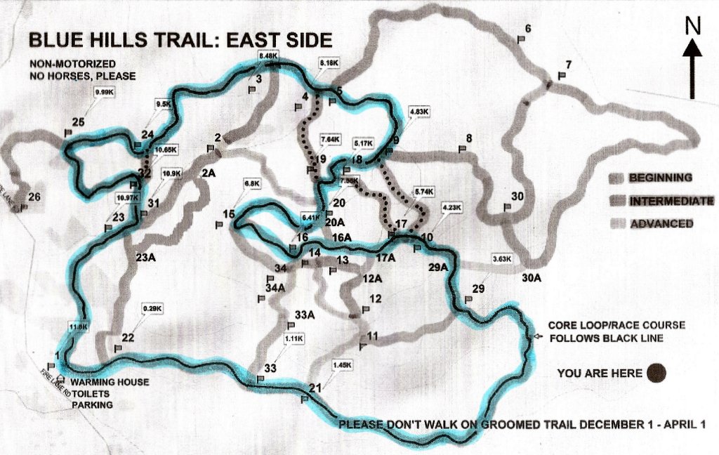
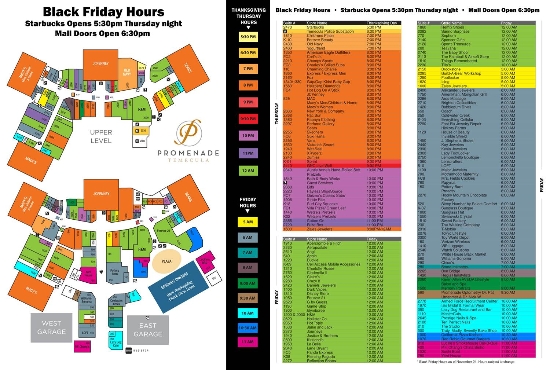
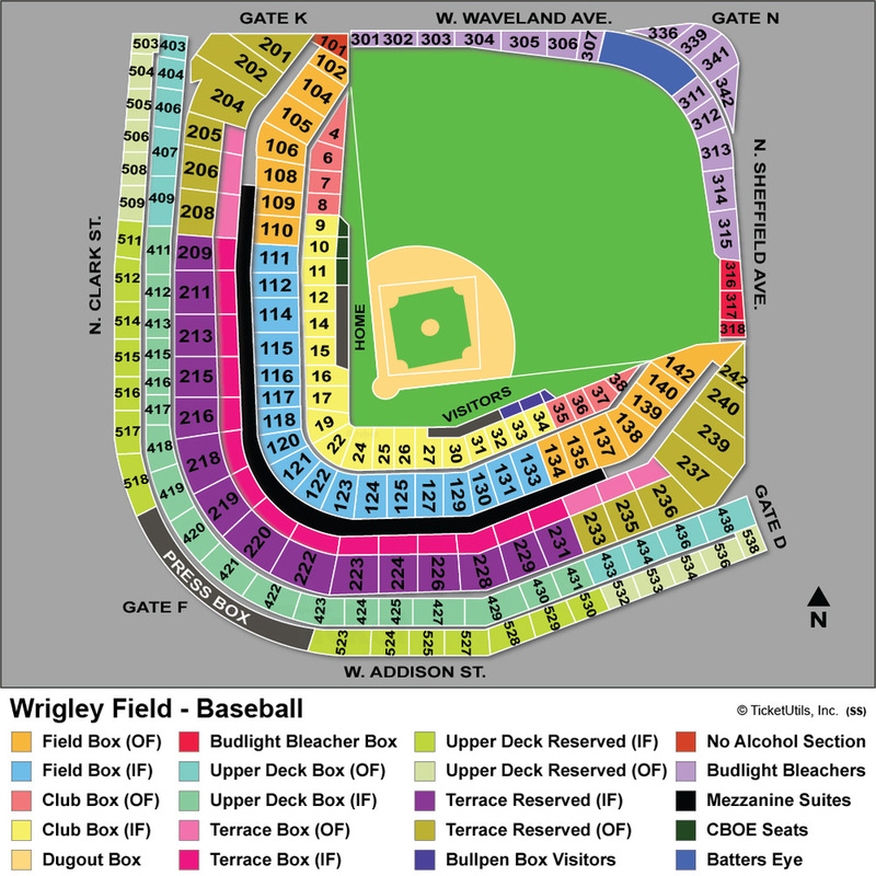
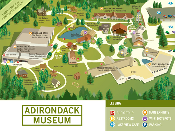
Which of the following would be considered a map?
|
|
|
|
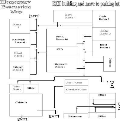
What is “Geography?”
Human beings are constantly moving around. You get up and walk from your bedroom to the kitchen and out the door to head to school. For some of you, your trip to school is on foot, others ride the bus or are driven to school by somebody else. You continue to move even at school. You enter the building and go to the lunchroom or gymnasium to wait for the first bell to direct you to your first period class. You walk down the hall to your locker and then the classroom. Every forty-five minutes or so you move again to another class. We just can’t stay in one spot for too long a time.
How do you know how to get from one place to another? What if today was your first day in this school? How do you find out where each of your classes is located? In a very basic sense, the concept of geography comes to your rescue.
Let’s take and break that word into parts: geo means “earth” or “land,” and a graph is a chart or written representation to identify that “land.” When you see a word ending in graphy that means that it is the study of whatever is the first part of the word. A “biography” is the study of a person’s life. Photography is the study of creating images using photographic devices. So, “geography” is the study of land. The official definition of geography could be stated as "the study of the earth and its land, water, and plant and animal life."
We use geography to study the earth around us and its complex relationships between people and their environments. This could mean finding the various rooms in the school building or it could mean examining the earthquake fault lines that run through our nation. Geography could represent learning about the physical conditions of Southeast Asia or France. There are many ways we could use geography.
Looking at geography, we find that there are five themes of geography.
When we look at the United States, we find many aspects of geography present.
Five Themes of Geography Slideshare:
http://www.slideshare.net/tbonnar/the-5-themes-of-geography-11708485
The five themes of geography are: 1.) location, 2.) place, 3.) human/environment interaction, 4.) movement, and 5.) region. Understanding these five themes will help you to study the earth and its peoples.
http://www.slideshare.net/tbonnar/the-5-themes-of-geography-11708485
The five themes of geography are: 1.) location, 2.) place, 3.) human/environment interaction, 4.) movement, and 5.) region. Understanding these five themes will help you to study the earth and its peoples.
Location
Location is knowing where you are. Your location right now may be the computer lab or at your bedroom desk, You location might also be your home’s physical address or our town. Every place has an exact position, an “absolute location” on the earth. Understanding latitude and longitude gives you the capability to learn a place’s absolute location. You might also use the term “relative location” to describe where a place is located in relation to other places. We live in the “Midwest,” that is a relative location because it is broad and unable to be completely drawn into boundaries. Still, relative location is helpful because we know that the Midwest is farther from the Atlantic Ocean than New England, another relative location.
Location is knowing where you are. Your location right now may be the computer lab or at your bedroom desk, You location might also be your home’s physical address or our town. Every place has an exact position, an “absolute location” on the earth. Understanding latitude and longitude gives you the capability to learn a place’s absolute location. You might also use the term “relative location” to describe where a place is located in relation to other places. We live in the “Midwest,” that is a relative location because it is broad and unable to be completely drawn into boundaries. Still, relative location is helpful because we know that the Midwest is farther from the Atlantic Ocean than New England, another relative location.
Place
Place is more than just a spot. The term also describes what a place is like. The features of the location as compared to another place. Does our community have tall mountains or dry desert areas? These type of physical characteristics are part of place. The plant and animal life and the climate could be part of the theme of place. Language, clothing and building styles may also play a role. Place describes "the typical characteristics that distinguish one place from another."
Place is more than just a spot. The term also describes what a place is like. The features of the location as compared to another place. Does our community have tall mountains or dry desert areas? These type of physical characteristics are part of place. The plant and animal life and the climate could be part of the theme of place. Language, clothing and building styles may also play a role. Place describes "the typical characteristics that distinguish one place from another."
Human/Environment Interaction
Humans have built bridges across rivers, dammed up rivers to produce hydroelectric energy and open up liveable space, and used explosives to knock down mountains and hills to make roads. These are all examples of human/environment interaction. This is when we live, travel, or change our environment or natural surroundings.
Our environment influences how we live. In Missouri we can have very cold winters and very hot summers. We have to come up with ways to survive in the weather conditions of our area. Farmers in Nebraska utilize long constructions of irrigation water pipelines to carry water to their crops. If you lived in the dry desert area of New Mexico you would need to find ways to provide water also.
Movement
Movement explains the way people in one place make contact with those in another area. This movement might be physical, such as travel by car, train, are boat. But it could also be the instant movement of information and resources by fax machine, email, telephone, etc. Movement describes "how people from different places interact."
Many of us have purchased things from other areas. We might buy things online or travel to another area to buy these things. People in Africa might where athletic wear popular in the United States, or East Asian musicians might learn popular songs sung in Nashville. People in North Dakota might eat bananas shipped from Central America.
Region
Regions are areas that share some common characteristics. They may be small or large. Region defines "parts of the earth that share common characteristics." I already mentioned the Midwest, that also could be considered a region. People that live in the Midwest share common characteristics, such as political, type of work, or eating habits. Small regions might be a neighborhood, city, or county. Large regions would be like the Midwest or the Southwest. A region could be defined because of the physical features of the area, like the landscape or climate.
Some regions are known for the cultural or economical similarities throughout. One of the earliest terms used for the central and mid-Southern region of the United States, running along the Mason-Dixon survey line and southward was the “Bible Belt.” The term was pinned to represent the strong Christian views, predominantly Baptist and Methodist, throughout the region. The region was known for stores being closed on Sundays and many areas restricted the use of alcohol or other practices in opposition to their religious beliefs.
Other regions known by the “belt” term include:
Corn Belt: Midwestern states where corn is a primary crop
Cotton Belt: Southern states where cotton is grown
Wheat Belt: Northern Midwestern states where they grow a lot of grain
Sun Belt: Southwestern states where the weather is hot and dry year-round. This region is popular among retiring Baby Boomers and sometimes is referred to as the Senior Belt.
Rust Belt: Great Lakes region states where manufacturing once was in abundance. Once known as the Steel Belt because of all of the industry related to automobiles and other manufacturing, this area suffered great economic downfall during the 1970s and 1980s. Many of the former industries closed down and thousands of jobs were lost. A good deal of the buildings sat empty after closing and the machinery sat unused. This is how the term “rust belt” came to be.
Map Projections
The best form of map is a globe. They are round, like the earth and landmasses and water can be accurately portrayed with the curvature of the globe. But try and carry a globe in your pocket or the glove box of your parent’s car. We have to rely on alternate forms of mapping to meet storage and usage demands.
The best form of map is a globe. They are round, like the earth and landmasses and water can be accurately portrayed with the curvature of the globe. But try and carry a globe in your pocket or the glove box of your parent’s car. We have to rely on alternate forms of mapping to meet storage and usage demands.
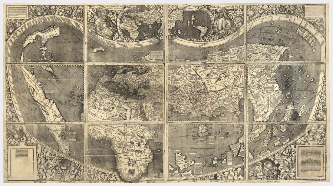

You can see the differences between the early world map rendition and a modern World map. While some landforms do look fairly the same, not all do.
We are fortunate that we have technology allowing us to take photographic images of the earth from space. This allows us to see the earth as it actually is, without any guessing on how big a continent is or the distance between two landforms.
There are several types of maps available to us today. Perhaps the projection closest to a global image is the “Goode’s Interrupted Projection” map.
There are several types of maps available to us today. Perhaps the projection closest to a global image is the “Goode’s Interrupted Projection” map.
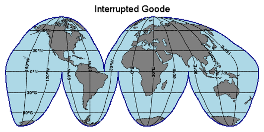
Also known as a “homolosine” projection map, the Goode’s Interrupted map was developed by John Paul Goode in 1923. It looks like someone took and peeled the skin off of a globe and laid it out flat on the table. This map shows the size and shape of landforms fairly accurately, but it fails to do the same for distance. It was developed as an alternative to the “Mercator Projection” map.
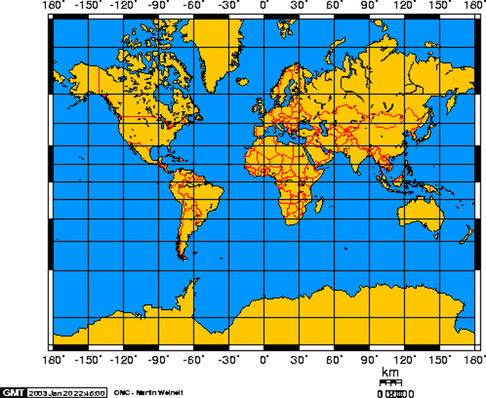
The map above is a “Mercator projection” map. These type of maps have been around since Geradus Mercator created his first one in 1569. You see land shapes accurately displayed, for the most part. The farther away from the Equator the more distorted land ends up being on a Mercator map. Just look at how huge Antarctica and Greenland look on the map above. The advantage of a Mercator map is that true directions are shown and make this type of map useful for sea travel.
The map above is a “Robinson projection” map. Arthur H. Robinson developed this map projection in 1963 when the Rand McNally company asked him to do so. It has been used by this company and many textbook publishers ever since. It is known as a “compromise” projection, in that it makes compromises for accuracy. The closer you get to the North or South Pole means the more distortion in showing land forms. It does project lines of longitude, or meridians as if they are drawing inward to the point of the Poles and gives a fairly accurate portrayal of the earth. Many classroom maps are Robinson projections.
Not all geographical services have continued to use the Robinson projection. While the National Geographic Society used the Robinson from 1988 to 1998, they switched to an earlier map projection that reduces the distortion of land masses as they near the poles. This currently used projection is the “Winkel tripel projection.”
Not all geographical services have continued to use the Robinson projection. While the National Geographic Society used the Robinson from 1988 to 1998, they switched to an earlier map projection that reduces the distortion of land masses as they near the poles. This currently used projection is the “Winkel tripel projection.”
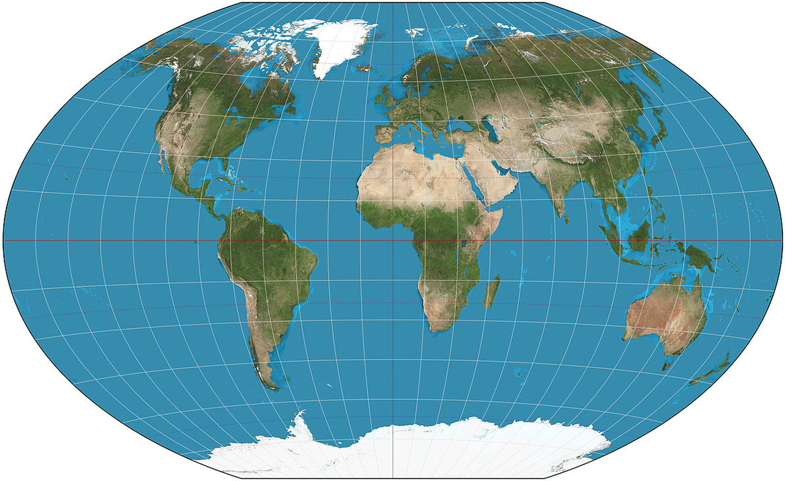
As you can see, the Winkel projection is similar to the Robinson, but does reduce distortion at the North and South poles.
You might find maps in any of these projections or a multitude of others. Each of them have their strengths and weaknesses. While we examine social studies, we can utilize any and all of these projections in understanding the geography of our world.
You might find maps in any of these projections or a multitude of others. Each of them have their strengths and weaknesses. While we examine social studies, we can utilize any and all of these projections in understanding the geography of our world.
Components of a map/Geographic concepts
If you had an orange, you would peel it and discover that it is divided into several sections. You might pull the orange into two halves and share it with a friend. Each person would have one half of the round object that was an orange, or a “half sphere.” The earth is partitioned into imaginary half spheres as well, but they are known as “hemispheres.”
If you had an orange, you would peel it and discover that it is divided into several sections. You might pull the orange into two halves and share it with a friend. Each person would have one half of the round object that was an orange, or a “half sphere.” The earth is partitioned into imaginary half spheres as well, but they are known as “hemispheres.”
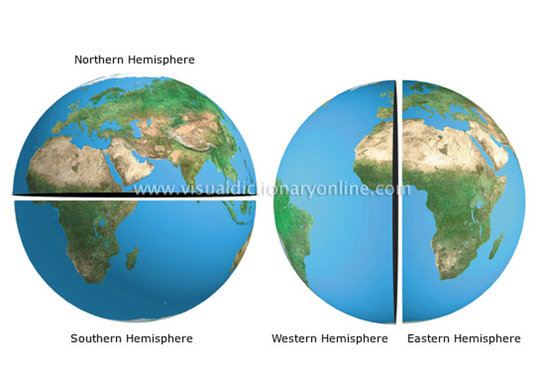
Like the split orange, the earth may be seen as two hemispheres that are known as the Western and Eastern Hemispheres. The Western Hemisphere is known as the home of North and South America as well as portions of other continents. The Eastern Hemisphere is the opposite half of the earth where most of Africa, Europe, and Asia are found. The two halves are separated by the Prime Meridian, which is the 0 degree longitude line and the International Date Line, or the 180 degree longitude. Horizontally, the earth maybe be separated with a northern half and a southern sections. With the equator being the border, the earth is divided into a northern hemisphere and a southern hemisphere. A location may be classified as part of more than one hemisphere. An example would be the United States. It is part of the Northern Hemisphere and the Western Hemisphere at the same time.
Latitude and Longitude
As mentioned earlier, there are imaginary lines drawn on many maps. These represent latitude and longitude measurements to find exact locations of places. Latitude lines run horizontally around the earth. You might say that “latitude is flatitude.” At the center of the earth the latitude line of 0 degrees is the Equator. All latitude lines run parallel, in that they never touch and are the same distance from each other. They increase in number as they move away from the equator. Those north of the equator are labelled with N for north and those south of the equator are labelled with S for south.
Lines of longitude are known as “meridians.” They run north to south from the North Pole to the South Pole. They all intersect at the poles as opposed to running parallel. Longitude is the distance measured in degrees east or west of the Prime Meridian, which is 0 degrees longitude. At the opposite side of the earth is the 180 degree meridian, the International Date Line. It is here that the date changes, one side of the meridian would be Monday while the other side would be Tuesday.
As longitude and latitude intersect, they form a grid system that can be used to find an exact location on a map or globe. This is known as the “absolute location” because it is absolutely the location of a place on the map.
Parts of a map
To understand how to use a map, we must understand the various parts of a map. All maps have some similarities, whether it’s a map to find your way to the bathroom at the mall, how to get to the ballfield in town, or where Berlin is located in Europe.
The main parts of a map are 1.) key, 2.) compass rose, and the 3.) scale bar.
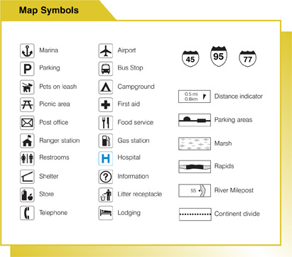
Like any key, the map key unlocks access to necessary material. Sometimes called the “legend,” the map key explains the symbols on a map. If I was to give you a road map of Missouri, you would find different ways that roads are displayed, various symbols or images for places you might find and different ways to identify cities and towns. There are several common symbols used on maps to represent various places. You might see an image of a tent to represent a campground or an airplane to represent an airport. Different types of roads are shown differently. Interstate highways and county roads do not look the same.
To understand how to use a map, we must understand the various parts of a map. All maps have some similarities, whether it’s a map to find your way to the bathroom at the mall, how to get to the ballfield in town, or where Berlin is located in Europe.
The main parts of a map are 1.) key, 2.) compass rose, and the 3.) scale bar.
Like any key, the map key unlocks access to necessary material. Sometimes called the “legend,” the map key explains the symbols on a map. If I was to give you a road map of Missouri, you would find different ways that roads are displayed, various symbols or images for places you might find and different ways to identify cities and towns. There are several common symbols used on maps to represent various places. You might see an image of a tent to represent a campground or an airplane to represent an airport. Different types of roads are shown differently. Interstate highways and county roads do not look the same.
|
|
The “compass rose” is a direction marker. For maps made to the north of the equator the compass rose uses North as the “cardinal direction.” There are actually four cardinal directions: North, South, East, and West. A compass rose might show all four, but often it is just an arrow with North displayed. If you know which direction is north then you should be able to know the other three.

|

|
Two common examples of a compass rose
Like a globe trying to give you a true-to-life representation of the earth, maps can be any size and display any portion of space. If 200 miles on one map is four inches of distance on the paper then how do we know what is 200 miles on another map? The resource provided is known as the “scale” or “scale bar.” The scale looks like a little ruler, typically located near the bottom of a map. It generally tells you how many what distance one inch on the map represents. Some maps may also show metric measurements using centimeters. This information will help you figure out distances on the map without every map having to be drawn to the same scale size.
This map of South Carolina and the surrounding area shows both a scale bar and compass rose. The compass rose is simply an arrow point pointing to the north. The scale bar shows the distance of 50 miles and is expected to be understood to represent one inch on the map.
This is basic map information and will assist you throughout life in understanding location and how to get to places you want to go.
This is basic map information and will assist you throughout life in understanding location and how to get to places you want to go.
